tMoA

Would you like to react to this message? Create an account in a few clicks or log in to continue.
tMoA

~ The only Home on the Web You'll ever need ~

5 posters

    Earth Changes 2015 Daily Updates

    Carol
    Carol
    Admin
    Admin


    Posts : 31757
    Join date : 2010-04-07
    Location : Hawaii

    Earth Changes 2015 Daily Updates Empty Earth Changes 2015 Daily Updates

    Post  Carol Sat May 17, 2014 4:52 pm

    Earth Changes 2015 Daily Updates Bn9mLLECQAACueg
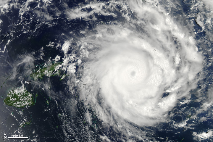
    Wild Wyoming cloud wows weatherwatchers
    Some epic structure by Clareton, WY several hours ago!!!

    A phenomenal shot of a massive cloud Sunday near Clareton, Wyo., has been making the rounds on social media today. The photo was taken by the Basehunters storm chasers group, who are "committed to capturing the most unique and close-up tornado footage on the market," according to their Facebook page. It shows the rotating updraft of a supercell thunderstorm over eastern Wyoming, according to Weather Channel meteorologist Jon Erdman. Supercells are the largest, strongest and longest-lasting thunderstorms. They are most common on the Great Plains. Known as a "low-precipitation" supercell, these types of storms seldom produce heavy rain or tornadoes, though they can produce large hail, Erdman said.


    Posted on May 17, 2014


    Earth Changes 2015 Daily Updates 362947_Bosnia-flooding

    May 2014 – BOSNIA - More than 20 people have been killed in the worst floods in more than a century in Serbia and Bosnia, authorities said on Saturday, with thousands evacuated from towns still under threat from rising rivers. The death toll in Bosnia alone reached 19, including nine found on Saturday when waters receded from the northeastern town of Doboj. Thousands of volunteers joined soldiers, police and fire-fighters in building flood barriers made of sandbags in the Serbian capital Belgrade and the western town of Sabac. The River Sava hit its highest-recorded level in Serbia, the army said, rising at a rate of three centimeters (one inch) per hour after several days of the heaviest rainfall in almost 120 years. Three people were confirmed dead in Serbia by Friday, and Prime Minister Aleksandar Vucic said there were more fatalities in the town of Obrenovac, 30 km (18 miles) southwest of Belgrade, where soldiers deployed huge amphibious vehicles to rescue hundreds of people crammed into a primary school. Authorities in Serbia said they would not give a death toll for Obrenovac, a town of some 30,000 people, until the waters had receded and the extent of the damage was clear. 


    A Reuters photographer said the entire town center was submerged under two to three meters (seven to 10 feet) of water. Tens of thousands of homes in Serbia were cut off from electricity and around 150,000 in Bosnia, where Doboj suffered the most. “It was especially difficult in Doboj because the flood waters acted as a tsunami, three to four meters high. No one could have resisted,” said Gojko Vasic, police chief in Bosnia’s autonomous Serb Republic. In Belgrade, residents donated food, clothes and bedding. Police appealed for more boats. A steady rain fell on Saturday and more was forecast for Sunday. “Now we have to sit and wait, to wait for that next wave and to hope,” Vucic told a joint news conference with Bosnian Serb leader Milorad Dodik. In the Bosnian border town of Bijeljina, authorities said they would evacuate 10,000 people. More than 15,000 have already been evacuated in Serbia. “We left behind the car, motorcycle, tools, all our furniture, valuables,” said Dragana Ilic, an Obrenovac resident evacuated to a shelter in Belgrade. “We just grabbed our mobile phones and left. All our IDs were left behind. The whole house is under water.” In Bosnia, helicopters evacuated people from the northern towns of Samac and Modrica and trucks and bulldozers carried food to the hardest hit areas. About 1,000 people, including babies, pregnant women, invalids and the elderly were evacuated from the region of Zeljezno Polje in central Bosnia, where hundreds of homes were destroyed in landslides. “I think we’ll never be able to return to our village,” local Muslim imam Zuhdija Ridzal told Reuters by telephone from Zeljezno Polje. “It has disappeared.” –Reuters


    Last edited by Carol on Mon May 11, 2015 1:46 pm; edited 5 times in total


    _________________
    What is life?
    It is the flash of a firefly in the night, the breath of a buffalo in the wintertime. It is the little shadow which runs across the grass and loses itself in the sunset.

    With deepest respect ~ Aloha & Mahalo, Carol
    Carol
    Carol
    Admin
    Admin


    Posts : 31757
    Join date : 2010-04-07
    Location : Hawaii

    Earth Changes 2015 Daily Updates Empty Re: Earth Changes 2015 Daily Updates

    Post  Carol Sat May 17, 2014 4:53 pm

    Posted on May 15, 2014


    Earth Changes 2015 Daily Updates Tropical-cyclone-ian-can-be-seen-skirting-fiji-this-image-by-nasas-aqua-satellite

    May 2014 – CLIMATE - According to a new study, powerful tropical cyclones are reaching peak intensity father from the equator and closer to the poles. Published today in the journal Nature, the study’s results show that over the past 30 years, tropical cyclones, or hurricanes and typhoons, are moving closer to the poles at a rate of about 33 miles per decade in the Northern Hemisphere and 38 miles per decade in the Southern Hemisphere. Kerry Emanuel, an MIT professor and co-author of the paper, says: “The absolute value of the latitudes at which these storms reach their maximum intensity seems to be increasing over time, in most places. The trend is statistically significant at a pretty high level.”  Emanuel says that trend seems consistent with a warming climate, adding that “it may mean the thermodynamically favorable conditions for these storms are migrating pole-ward.” The implications of these results are serious as the movement of peak intensity means regions further north and south of the equator, which before haven’t had to endure many landfalls by dangerous cyclones, may have greater exposure to these extreme weather events. This could lead to “potentially profound consequences to life and property” and “any related changes to positions where storms make landfall will have obvious effects on coastal residents and infrastructure.”
    To conduct the study the researchers used international data from 1982 to 2012 that was collected by NOAA’s National Climactic Data Center and used the location of peak intensity of cyclones as a benchmark because it is a more consistent metric than statistics such as storm duration. There are regional differences in the pole-ward movement of cyclones, the fact that every ocean basin other than the northern Indian Ocean has experienced this change leads the researchers to suggest that this “migration away from the tropics is a global phenomenon.” Emanuel adds that the global mechanisms that underlie the trend are a matter for additional research. –Cleveland Leader


    _________________
    What is life?
    It is the flash of a firefly in the night, the breath of a buffalo in the wintertime. It is the little shadow which runs across the grass and loses itself in the sunset.

    With deepest respect ~ Aloha & Mahalo, Carol
    Carol
    Carol
    Admin
    Admin


    Posts : 31757
    Join date : 2010-04-07
    Location : Hawaii

    Earth Changes 2015 Daily Updates Empty Re: Earth Changes 2015 Daily Updates

    Post  Carol Sat May 17, 2014 4:54 pm

    Posted on May 15, 2014


    Earth Changes 2015 Daily Updates 16x9

    May 2014 – CALIFORNIA - For years, scientists have wondered about the forces that keep pushing up California’s mighty Sierra Nevada and Coast Ranges, causing an increase in the number of earthquakes in one part of Central California. On Wednesday, a group of scientists offered a new, intriguing theory: The quakes are triggered in part by the pumping of groundwater in the Central Valley, which produces crops that feed the nation. “These results suggest that human activity may give rise to a gradual increase in the rate of earthquake occurrence,” said the study published in the journal Nature. “During wet periods of time when the fault is loaded down, the forces that are keeping the fault clamped down are greater. It inhibits the sliding of the fault,” says Colin B. Amos, assistant professor of geology at Western Washington University. Using new GPS data, the scientists found that mountains closest to California’s thirsty Central Valley were growing at a faster-than-expected rate compared to nearby ranges. The growth spurt — about 1 to 3 millimeters a year — was enough to lift them by half a foot over the last 150 years. Groundwater is very heavy, and its weight depresses the Earth’s upper crust. Remove the weight, and the crust springs upward — and that change in pressure can trigger more small earthquakes, the researchers said. “It reduces the forces that are keeping the fault clamped together — leading to more small earthquakes during dry periods of time,” said Colin B. Amos, assistant professor of geology at Western Washington University, the study’s lead author.
    Other scientists studying a seismically active area of southern Monterey County near Parkfield observed that there tend to be more earthquakes during dry months than during wet months. The number of earthquakes there every year has roughly doubled between 1984 and 2005. “During wet periods of time when the fault is loaded down, the forces that are keeping the fault clamped down are greater. It inhibits the sliding of the fault,” Amos said. But the question as to why earthquakes have been increasing in Parkfield over time has been a mystery. The groundwater theory introduced by Amos and his colleagues gives one possible answer. “Over the long term, because we’re losing more groundwater, it could give rise to more seismicity by reducing these overall forces,” Amos said. Groundwater has been slowly depleted in the Central Valley to quench the thirst of farms and cities since the mid-1800s. That irrigation has already caused dramatic changes. In the 1930s, water diversions prompted the disappearance of Tulare Lake, once the largest body of fresh water west of the Mississippi, which was 60 miles across. Over the last hundred and fifty years, the Central Valley’s groundwater reserve has lost about 38 cubic miles of water — enough to drain Lake Tahoe. According to the U.S. Geological Survey, Central Valley aquifers supply about 20% of the nation’s groundwater needs, making it the second-most-pumped aquifer system in the United States. The Central Valley produces one-quarter of the nation’s food, including 40% of its fruits and nuts.
    The study published Wednesday does not suggest the next Big One to hit Los Angeles or San Francisco will be caused by human activity, Amos said. “Large earthquakes are going to occur on the San Andreas fault no matter what we do,” Amos said. But what is important is the idea that human activity could trigger more seismic movement. “It’s really opening up a possibility that humans are changing stresses on faults,” Amos said. “It’s a simple realization that human use of groundwater is having small but perhaps measurable impacts on the San Andreas Fault.” U.S. Geological Survey seismologist Susan Hough, who was not affiliated with the study, said the idea that groundwater depletion can trigger earthquakes is very plausible. Hough went a step further than the researchers, saying it’s possible that smaller earthquakes in the Parkfield area could eventually trigger larger earthquakes that head south toward Los Angeles. “If you raise the rate of little earthquakes, you also raise the probability of a bigger earthquake,” Hough said. Parkfield was the starting point of a magnitude 7.9 earthquake that hit the San Andreas fault in 1857. The fault unzipped south for nearly 200 miles, down to the San Gabriel Mountains and ending near Wrightwood. That fault was so massive that shaking lasted from 1 to 3 minutes, trees were uprooted, and buildings were destroyed. “As near as we can tell, the foreshocks were in the Parkfield area,” Hough said. “It won’t necessarily happen that way” again in our lifetime, she said. “But the fact that it did happen once means that it could happen.” Hough said further study was needed to determine whether groundwater depletion in other areas could also trigger earthquakes. The part of the San Andreas Fault around Parkfield is fairly weak — meaning not much change in pressure is needed to loosen the fault and cause earthquakes. In contrast, sections of the San Andreas closer to San Francisco and Los Angeles are much stronger and more locked. Steve Ingebritsen, hydrogeologist with the U.S. Geological Survey who was also unaffiliated with the study, called the theory “an interesting hypothesis from a credible group of investigators that will drive more research.” He called the suggestion that groundwater depletion could lead to more earthquakes “somewhat controversial” and that more study is needed elsewhere in California and around the world to see if the findings can be replicated. – LA Times


    _________________
    What is life?
    It is the flash of a firefly in the night, the breath of a buffalo in the wintertime. It is the little shadow which runs across the grass and loses itself in the sunset.

    With deepest respect ~ Aloha & Mahalo, Carol
    burgundia
    burgundia


    Posts : 5520
    Join date : 2010-04-09
    Location : Poland

    Earth Changes 2015 Daily Updates Empty Re: Earth Changes 2015 Daily Updates

    Post  burgundia Sat May 17, 2014 6:03 pm

    The situation in serbia and Bosnia and herzegovian is critical...

    If you can help donating even $1, please do. Here is the link:

    http://www.youcaring.com/pet-expenses/please-help-poor-animals-and-people-in-bosnia-to-survive-/179329

    lindabaker
    lindabaker


    Posts : 1385
    Join date : 2010-04-15
    Location : straight ahead

    Earth Changes 2015 Daily Updates Empty Re: Earth Changes 2015 Daily Updates

    Post  lindabaker Sat May 17, 2014 6:15 pm

    Has anyone heard from Beren? He is from Belgrade and his Mum still lives there...
    Carol
    Carol
    Admin
    Admin


    Posts : 31757
    Join date : 2010-04-07
    Location : Hawaii

    Earth Changes 2015 Daily Updates Empty Re: Earth Changes 2015 Daily Updates

    Post  Carol Sat May 17, 2014 6:22 pm

    He was on mudra's thread the other day.


    _________________
    What is life?
    It is the flash of a firefly in the night, the breath of a buffalo in the wintertime. It is the little shadow which runs across the grass and loses itself in the sunset.

    With deepest respect ~ Aloha & Mahalo, Carol
    mudra
    mudra


    Posts : 23223
    Join date : 2010-04-09
    Age : 69
    Location : belgium

    Earth Changes 2015 Daily Updates Empty Re: Earth Changes 2015 Daily Updates

    Post  mudra Mon May 19, 2014 4:16 pm

    Thousands of wartime explosives dislodged as Balkan flooding leads to landslides

    Earth Changes 2015 Daily Updates 21.si
    An aerial view of the flooded city of Orasje May 18, 2014. Russian cargo planes and rescue teams from around Europe on Sunday joined huge volunteer aid efforts in swathes of Serbia and Bosnia where at least 24 people have died in the worst floods in over a century.(Reuters / Dado Ruvic)

    While dozens of people have died as a result of massive floods sweeping the Balkans, leaving tens of thousands displaced, a new risk has been posed by unexploded wartime landmines that are now being exposed by 3,000 landslides.

    “The consequences...are terrifying,” Bosnian Foreign Minister Zlatko Lagumdzija told a news conference on Monday. “The physical destruction is not less than the destruction caused by the war.”

    Bosnia’s Mine Action Center warned on Monday that: “Water and landslides have possibly moved some mines and taken away mine warning signs,” Sasa Obradovic, a center official, told AFP. Teams have been assessing the threat and have issued a warning to residents.

    Aerial flood footage: 'Worst in century' deluge swamps Balkans https://www.youtube.com/watch?v=_zaQKwkYGO0


    Some 120,000 unexploded landmines were left buried in Bosnia after the 1992-1995 Bosnian War – approximately 2.4 percent of the Yugoslav republic is covered with both unexploded mines and similar devices.

    “They must be extremely cautious when they start cleaning their houses, land, or gardens, as the remaining mud could hide mines and other explosive devices brought by rivers,” Obradovic said.

    read on: [url=http://rt.com/news/159984-landmines-flood-balkans-landslide/ ]http://rt.com/news/159984-landmines-flood-balkans-landslide/ [/url]

    Love Always
    mudra

    bobhardee
    bobhardee


    Posts : 3445
    Join date : 2012-09-08
    Age : 74
    Location : The Sandhills of SC

    Earth Changes 2015 Daily Updates Empty Re: Earth Changes 2015 Daily Updates

    Post  bobhardee Mon May 26, 2014 7:37 pm

    5 26 2014 This is an excellent review for April 2014

    https://www.youtube.com/watch?v=Oj6vUxgYBSY
    mudra
    mudra


    Posts : 23223
    Join date : 2010-04-09
    Age : 69
    Location : belgium

    Earth Changes 2015 Daily Updates Empty Re: Earth Changes 2015 Daily Updates

    Post  mudra Fri May 30, 2014 3:47 pm

    5/27/2014 -- Helicopter view of Colorado 4 MILE LONG Landslide @ Fracking Operation

    https://www.youtube.com/watch?v=lJbLEX432ns


    From Dutchsince on Facebook: https://www.facebook.com/photo.php?fbid=740968909288869&set=a.363126717073092.106418.296574443728320&type=1&theater

    For those who don't understand, or those who are trying to deny the fracking connection to this huge Colorado landslide... let me explain a bit more.

    First, no one can deny there is indeed a fracking operation at the landslide location. This is a fact.

    In order to explain why this 4 mile landslide occurred at the fracking operation, you must first understand how the plate is moving currently, and how the weak spots are showing excessive movement.

    Current examples of the weak spot / craton edge movement...

    The earthquake swarms in Idaho near Red Butte (western portion of the yellowstone magma chamber) , and swarms at Yellowstone park itself, all swarms happening over the past 2 months....

    Also, the huge landslide in Washington State (preceded by an earthquake)... the other landslide in Jackson Hole Wyoming at a dormant volcanic Butte... the earthquake swarms at the fracking operations in Oklahoma + Texas + South Colorado, the odd earthquakes in Utah, Nevada and California at the dormant volcanic sites, the larger earthquakes off the coast of California and Oregon at the fresh lavic fields.... the announcement that magma chambers in the Pacific Northwest at Mount Saint Helens and Yellowstone are "recharging"......

    Finally, the confirmation that Yellowstone has raised FOUR inches, and moved 1inch Southeast since NEW YEARS . Yellowstone located along the edge of the craton, proves the edge is being moved SOUTHEAST....... add in the earthquakes along the Southern + Eastern edges of the craton , movement in Virginia, Quebec Canada, Oklahoma, Kansas, Texas, Missouri, and Tennessee.

    Put it all together.... the craton edge is being displaced. The weak spots, such as dormant volcanic chains, new lavic fields, and FRACKING operations are showing heavy movement . This is due to the entire edge of the North American craton being displaced (as evidenced by the earthquake activity occurring directly upon the edge of it).

    Fracking operations contain hundreds (in some cases thousands) of drill sites. Each drilled out shaft is nothing more than a man made "tube" in the ground. Similar to what mother nature would produce in a volcanic chain. Multiple fractures out of hollow tubes in the ground. Earthquakes occur naturally at the weak points.... like a perforation in a box makes it easy to bend, the perforations in the crust provide a point for pressure release.

    Officals are quick to jump to "flooding" in these landslide events. Normally, I would not disagree, however the location of this huge collapse in Colorado , screams out to me as being tectonic related.

    Flooding was the "reason" used in Washington State, also in Jackson Hole Wyoming. A week or so after Jackson Hole actually split in half, the main stream media acknowledged it was a BUTTE which split, not due to flooding. The Washington state landslide was hushed up very quickly after the announcement that a SEISMIC EVENT (1.0M to 2.0M) occurred about an hour before the landslide.

    This Colorado landslide appears to be more rock and sand than any "water". Don't see flooding waters, no running streams, not even much "mud" in any of the shots.

    My best informed guess on this, is that craton pressure caused a fracture at the fracking operation. Possibly an underground aquifer, mixed with frack sand pumped in under high pressure for several years is what caused this massive "flow".

    Not seeing the WATER that could have caused this... anyone have ANY PROOF of water? All I'm seeing is rock and sand mixed with trees knocked over at HIGH SPEED .. like a lahar flow, not a mud slide.

    Speaking of Lahar flows, Dotsero volcano is just 50 miles Northeast , Colorado's only well known volcano which is located of I-70..... also due North are the Hot Springs, and just North of the Hot Springs is Jackson Hole which had its own collapse.

    We can expect more movement (earthquake wise) along the edge of the craton , which means we can expect future large collapses like this in the future.

    (collapse isn't the right term, at this point, I'd call this an "eruption" of debris coming from a mix of an aquifer with a fracking operation under high pressure all being released at once due to a larger plate movement issue)

    Earth Changes 2015 Daily Updates 1488280_740968909288869_3088155410647089843_n

    Love Always
    mudra
    mudra
    mudra


    Posts : 23223
    Join date : 2010-04-09
    Age : 69
    Location : belgium

    Earth Changes 2015 Daily Updates Empty Re: Earth Changes 2015 Daily Updates

    Post  mudra Sat May 31, 2014 4:26 pm

    5/31/2014 -- 4 Mile Long eruption of Liquid Sand + stored CO2 @ Fracking operation in Colorado

    https://www.youtube.com/watch?v=X2Omha8C4WY


    Love Always
    mudra
    mudra
    mudra


    Posts : 23223
    Join date : 2010-04-09
    Age : 69
    Location : belgium

    Earth Changes 2015 Daily Updates Empty Re: Earth Changes 2015 Daily Updates

    Post  mudra Mon Jun 02, 2014 10:31 am


    Indonesian volcanic ash cloud may halt Australia flights for days

    Bali, Singapore routes from Darwin closed amid fears flights around Australia may be affected by massive eruption


    Earth Changes 2015 Daily Updates 41ee1f70-f8dc-42c8-a8fe-346c63d63412-460x276

    Flights across northern Australia could be affected for days after a volcanic eruption in Indonesia sent a vast ash cloud over the region.

    Qantas and Virgin Australia have confirmed all their flights to and from the Northern Territory capital of Darwin have been cancelled after Sangeang Api, a volcano off the Indonesian island of Sumbawa, erupted at least three times since Friday.

    Deputy prime minister Warren Truss said the ash cloud was between 6km and 13km in the atmosphere and and could affect flights as far south as Brisbane.

    "Depending on wind and other weather conditions, the ash has the potential to affect flights to and from other airports, including Brisbane, during coming days. This is currently being fully assessed," he said.

    Airservices Australia, the nation's air navigation authority, the Civil Aviation Safety Authority and the Bureau of Meteorology are all investigating the cloud, Mr Truss said.

    "Depending on wind and other weather conditions, the ash has the potential to affect flights to and from other airports, including Brisbane, during coming days. This is currently being fully assessed," he said.

    "Passengers are advised to check with their airlines for further information."

    Airservices Australia has begun diverting international flights around the ash cloud.

    read on:  Arrow http://www.theguardian.com/world/2014/may/31/indonesian-volcanic-ash-cloud-halts-flights-in-and-out-of-darwin

    Love Always
    mudra

    bobhardee
    bobhardee


    Posts : 3445
    Join date : 2012-09-08
    Age : 74
    Location : The Sandhills of SC

    Earth Changes 2015 Daily Updates Empty Re: Earth Changes 2015 Daily Updates

    Post  bobhardee Mon Jun 02, 2014 7:56 pm

    bobhardee
    bobhardee


    Posts : 3445
    Join date : 2012-09-08
    Age : 74
    Location : The Sandhills of SC

    Earth Changes 2015 Daily Updates Empty Re: Earth Changes 2015 Daily Updates

    Post  bobhardee Sat Jun 14, 2014 12:24 pm

    June14 , 2014 This is an excellent global review of earth changes for the month of May 2014

    https://www.youtube.com/watch?v=udVQFKd8Vpc
    bobhardee
    bobhardee


    Posts : 3445
    Join date : 2012-09-08
    Age : 74
    Location : The Sandhills of SC

    Earth Changes 2015 Daily Updates Empty Re: Earth Changes 2015 Daily Updates

    Post  bobhardee Sat Jun 21, 2014 7:07 pm

    bobhardee
    bobhardee


    Posts : 3445
    Join date : 2012-09-08
    Age : 74
    Location : The Sandhills of SC

    Earth Changes 2015 Daily Updates Empty Re: Earth Changes 2015 Daily Updates

    Post  bobhardee Fri Jun 27, 2014 1:57 pm

    bobhardee
    bobhardee


    Posts : 3445
    Join date : 2012-09-08
    Age : 74
    Location : The Sandhills of SC

    Earth Changes 2015 Daily Updates Empty Re: Earth Changes 2015 Daily Updates

    Post  bobhardee Tue Jul 08, 2014 6:35 am

    error


    Last edited by bobhardee on Wed Jul 09, 2014 8:36 am; edited 1 time in total
    mudra
    mudra


    Posts : 23223
    Join date : 2010-04-09
    Age : 69
    Location : belgium

    Earth Changes 2015 Daily Updates Empty Re: Earth Changes 2015 Daily Updates

    Post  mudra Tue Jul 08, 2014 2:08 pm

    Half-million people evacuated in Japan amid 'worst-in-15-years' typhoon

    A super typhoon with destructive winds, towering waves and storm surges is heading to the Japanese island of Okinawa. Authorities have canceled flights and urged over 500,000 people to evacuate as meteorologists issued the highest storm warning.

    One person has been reported dead in Typhoon Neoguri after his boat was swamped by high waves, reported NHK national television. Several people also sustained minor injuries from falls.

    The typhoon alert was issued for Okinawa, Japan’s southernmost territory and home to around 1.2 million residents, and for the Miyako Islands in the same prefecture.

    The super storm is packing gusts of up to 250kph, the Japan Meteorological Agency said, issuing a top-level warning.

    According to the official from the agency, the waves could reach as high as 14 meters.

    Some schools in the south of Japan’s main islands have been closed, and the authorities halted air and sea transport.

    read on:  Arrow http://rt.com/news/171172-japan-typhoon-okinawa-evacuate/

    Love Always
    mudra
    mudra
    mudra


    Posts : 23223
    Join date : 2010-04-09
    Age : 69
    Location : belgium

    Earth Changes 2015 Daily Updates Empty Re: Earth Changes 2015 Daily Updates

    Post  mudra Wed Jul 09, 2014 2:38 pm

    Earth Changes 2015 Daily Updates Enelogo

    Weather Channel, July 9, 2014: […] torrential rains have moved in with feeder bands in the wake of Neoguri’s passage. Rainfall totals of 13 to 16 inches were reported at several locations on [Okinawa] as of 7:40 a.m. local time Wednesday.

    Japan Times, July 9, 2014: Authorities warned of record rainfall in Okinawa as some rivers overflowed.

    Wall St. Journal, July 9, 2014: “Okinawa Prefecture is experiencing heavy rains on an unseen scale,” said Satoshi Ebihara, head of the agency’s weather-forecast division, at a news conference Wednesday morning.

    NBC News, July 8, 2014: One of the biggest and strongest typhoons to hit during Japan’s summer months churned past Okinawa [...] The Japan Meteorological Agency was forecasting that parts of Shikoku, in western Japan, could receive the equivalent of three months of the normal amount of rainfall in just two days […] forecasters said the storm’s wide area and slow movement could add to the potential damage. [...] heavy downpours could cause landslides and flooding if the typhoon moves across the Japanese archipelago as expected on Thursday or Friday.

    CNN: 45 ft. waves off Japan coast from massive typhoon — Storm Chaser: “Biggest I’ve ever seen… absolutely overwhelming” — Official: “Rains on an unseen scale” — “High danger of landslides” — Record rainfall up to 16 inches already — Astronaut: “Neoguri has been literally cut in half… Unreal” (VIDEO)

    http://enenews.com/cnn-45-ft-waves-off-japan-coast-expert-biggest-waves-ive-ever-seen-absolutely-overwhelming-official-rains-on-an-unseen-scale-high-danger-of-landslides-record-rainfall

    Love Always
    mudra
    bobhardee
    bobhardee


    Posts : 3445
    Join date : 2012-09-08
    Age : 74
    Location : The Sandhills of SC

    Earth Changes 2015 Daily Updates Empty Re: Earth Changes 2015 Daily Updates

    Post  bobhardee Sat Jul 12, 2014 9:12 pm

    mudra
    mudra


    Posts : 23223
    Join date : 2010-04-09
    Age : 69
    Location : belgium

    Earth Changes 2015 Daily Updates Empty Re: Earth Changes 2015 Daily Updates

    Post  mudra Mon Jul 21, 2014 2:03 pm

    7/20/2014 — Strange EXPLODING Sinkholes in Central Florida + Siberia Russia

    July 20, 2014

    A strange geologic event occurred in Central Florida.

    Residents of Spring Hill, FL were surprised to see (and feel) a large underground “explosion”, which sent the ground UPWARD before collapsing into a sinkhole.

    http://abcnews.go.com/US/day-sinkhole-emerges-florida/story?id=24638029

    Exploding sinkholes. Not normally something we hear about twice in the same week.

    Twice you ask? Maybe you didn’t hear about the exploded sinkhole in Siberia Russia which made the news rounds about 5 days ago.

    http://www.dailymail.co.uk/travel/travel_news/article-2693105/Giant-hole-appears-Siberia-Huge-crater-emerges-end-world.html

    Earth Changes 2015 Daily Updates Hqdefault

    more on Dutchsince web site: http://dutchsinse.tatoott1009.com/7202014-strange-exploding-sinkholes-in-central-florida-siberia-russia/

    Love Always
    mudra
    bobhardee
    bobhardee


    Posts : 3445
    Join date : 2012-09-08
    Age : 74
    Location : The Sandhills of SC

    Earth Changes 2015 Daily Updates Empty Re: Earth Changes 2015 Daily Updates

    Post  bobhardee Fri Aug 08, 2014 6:50 pm

    8/8/2014
    Scott Report for the month of July 2014

    https://www.youtube.com/watch?v=hqr21oeBVz4
    bobhardee
    bobhardee


    Posts : 3445
    Join date : 2012-09-08
    Age : 74
    Location : The Sandhills of SC

    Earth Changes 2015 Daily Updates Empty Re: Earth Changes 2015 Daily Updates

    Post  bobhardee Fri Aug 08, 2014 7:04 pm

    mudra
    mudra


    Posts : 23223
    Join date : 2010-04-09
    Age : 69
    Location : belgium

    Earth Changes 2015 Daily Updates Empty Re: Earth Changes 2015 Daily Updates

    Post  mudra Wed Aug 20, 2014 4:21 pm

    Iceland evacuates areas close to rumbling volcano

    Reykjavik (AFP) - Iceland on Tuesday began evacuating areas close to its largest volcano after warnings of a possible eruption, four years after millions of air travellers were grounded by a huge ash cloud from another peak.

    Scientists believe the ash from an eruption at Bardarbunga, a huge volcano under Iceland's largest glacier, the Vatnajokull in the south of the country, could disrupt transatlantic and northern European air traffic.

    They also fear floods from melting ice could cause serious damage to the country's infrastructure.

    On Tuesday, police announced that they had "decided to close and evacuate the area north of Vatnajokull as a result of seismic activity on the Bardarbunga".

    Read on: Arrow http://news.yahoo.com/threat-flights-icelands-biggest-volcano-rumbles-152308522.html

    Love Always
    mudra
    mudra
    mudra


    Posts : 23223
    Join date : 2010-04-09
    Age : 69
    Location : belgium

    Earth Changes 2015 Daily Updates Empty Re: Earth Changes 2015 Daily Updates

    Post  mudra Wed Aug 20, 2014 4:47 pm

    8/20/2014 -- Giant fissure opens in North Mexico -- 1km long / 25 feet deep -- Major movement

    https://www.youtube.com/watch?v=MmS3dhGISHU


    Love Always
    mudra
    mudra
    mudra


    Posts : 23223
    Join date : 2010-04-09
    Age : 69
    Location : belgium

    Earth Changes 2015 Daily Updates Empty Re: Earth Changes 2015 Daily Updates

    Post  mudra Sun Aug 24, 2014 2:05 pm

    Two quakes shake Icelandic volcano's area, govt restricts airspace

    Scientists said their announcement Saturday that the volcano had experienced a subglacial eruption was wrong.

    "Observations show that a sub-glacial eruption did not occur yesterday. The intense low-frequency seismic signal observed yesterday has therefore other explanations," the Icelandic Met Office said.

    The Met Office still warns that seismic activity at the volcano was not slowing, and an eruption remained a possibility in coming days.

    The local authorities are keeping the country’s airspace open, but have declared a no-fly zone of 100 nautical miles by 140 nautical miles around the eruption zone.

    But, the no-fly zone could be expanded if the eruption melts the ice and spews volcanic ash.

    Love Always
    mudra


      Current date/time is Fri May 10, 2024 12:26 pm